| ← Back stroke | Next swim → |
Pine Island BeachMurrumbidgee River, Greenway ACT
| World Home Page |
| Australia Home |
| NSW / ACT Home |
| NSW and ACT Regions: |
| Canberra and ACT |
| South Coast |
| Southern Inland |
| Sydney |
| Other information: |
| Water Safety |
| Map |
| List of Lists |
| Your Support |
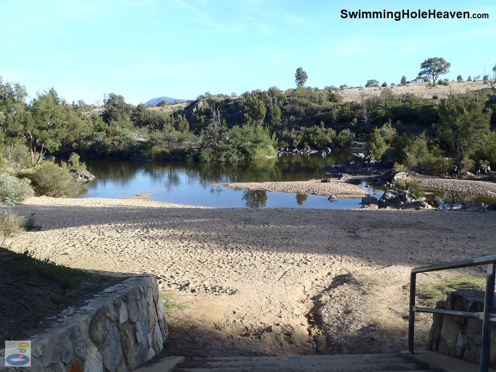
Pine Island Beach is a bay of calm water in the Murrumbidgee River that has formed behind the small island
in the river that gives Pine Island Reserve its name. The water in this inlet is slightly warmer than
the main current, and under low flow conditions is better suited to less experienced swimmers than most
other spots along the Murrumbidgee River corridor in the ACT.
 Above: Pine Island Beach viewed from the steps
(Order this image)
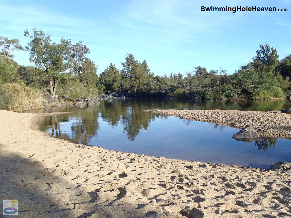
The sand accumulated behind the island creates a 40 metre stretch of beach that extends well back from the water, with patches of sand also on the island itself. It is quite fun to explore around this tiny island, with its rocky outcrops, gently undulating dunes and little pools around its edge.
The island is only around 30 metres in both directions. When the river is low and
the anabranch is not flowing, it is difficult to recognise the island as such, because it is connected to the beach.
When the water is slightly deeper, you can wade or rock hop out to the island, where there are patches of sand and shade.
To reach Pine Island Beach, when you enter the Recreation Area, look for one of the car parks immediately to the right. Here you'll find a lawn area, which tends to dry out in summer, picnic facilites, a toilet block, and a kids' playground that is at the far end of the furthest car park, and well away from the beach.
To reach the beach, follow the signs and
head down the steps towards the sand, which you can see from the top of the hill before you descend. There are no facilities
on the beach itself.
 Above: The tip of Pine Island from the water's edge
(Order this image)
Pine Island Reserve is one of six swimming spots that were formally recommended by the ACT Minister for Territory and Municipal Services. The Minister described it as "a long-time family favourite" (20/12/12). Pine Island South is around 700 metres upstream of Pine Island Beach, with its own car park and facilities, so I have documented its features separately from Pine Island Beach.
Water quality in the Canberra area can sometimes be unsuitable for swimming. For regular updates on whether the water quality at this site is suitable for swimming, see the ACT Government's water quality alerts. Signs on site indicate when the river is closed for swimming due to poor water quality. As a general rule, don't plan to swim here after rain because the river may be closed to swimming due to agricultural runoff from upstream areas (i.e. animal faeces, fertilisers, herbicides, pesticides, etc.).
View Larger Map
 Above: Pine Island Beach viewed from the steps
(Order this image)
The sand accumulated behind the island creates a 40 metre stretch of beach that extends well back from the water, with patches of sand also on the island itself. It is quite fun to explore around this tiny island, with its rocky outcrops, gently undulating dunes and little pools around its edge.
To reach Pine Island Beach, when you enter the Recreation Area, look for one of the car parks immediately to the right. Here you'll find a lawn area, which tends to dry out in summer, picnic facilites, a toilet block, and a kids' playground that is at the far end of the furthest car park, and well away from the beach.
 Above: The tip of Pine Island from the water's edge
(Order this image)
Pine Island Reserve is one of six swimming spots that were formally recommended by the ACT Minister for Territory and Municipal Services. The Minister described it as "a long-time family favourite" (20/12/12). Pine Island South is around 700 metres upstream of Pine Island Beach, with its own car park and facilities, so I have documented its features separately from Pine Island Beach.
Other Information Before You Go:
Location: Pine Island Reserve, Pine Island Road, Greenway, ACT, 25 km (approx. 30 min. drive) south-west of Canberra Central.
Latitude:-35.428923 Longitude:149.062582
Getting there: From Parliament House, head west along Adelaide Avenue / Cotter Road and then south along Tuggeranong Parkway / Drakeford Drive. At Greenway, turn right into Athllon Dr and after 700 metres turn left into Don Dunstan Drive and immediately right into Pine Island Road.
When you reach the Pine Island Reserve, the
Pine Island Beach car park is on the right hand side just after going through the reserve entrance.
Facilities: Car park, toilets, lawn, barbecues, picnic tables, playground. No rubbish bins provided, so take your rubbish home with you.
Entrance fee: None
Water temperature: Mild
Water clarity: Clear to cloudy
Under foot: Sand, rock
Maximum water depth: 1 to 2 metres
Suggested minimum swimming proficiency required: Beginners under low flow conditions close to the main beach. Experienced at other times and in the main current on the far side of the island
Prohibitions including whether you can bring your dog: No dogs, no camping, no fires. Collection of standing or fallen timber is illegal.
Sun shade: Limited to no shade available on the beach or in the water.
Opening times: Gates open 8am to 6pm in winter, and 8am to 9pm during daylight savings
Wheelchair access: None
Managing authority: ACT Government
Nearby attractions: Pine Island South swimming hole, 700 metres upstream, or Kambah Pool swimming hole, 7 km downstream.
Before you head out, make sure to read the
swimming safety information and check with the managing authority for any current change of conditions. Specific to this site, the managing authority advises that there are
strong currents, shallow water, submerged objects, deep water, slippery and uneven ground, steep banks and snakes. The managing authority
also advises that mobile phone reception is not reliable throughout the Murrumbidgee River corridor, so do not depend on your phone
for safety or directions.
Latitude:-35.428923 Longitude:149.062582
Getting there: From Parliament House, head west along Adelaide Avenue / Cotter Road and then south along Tuggeranong Parkway / Drakeford Drive. At Greenway, turn right into Athllon Dr and after 700 metres turn left into Don Dunstan Drive and immediately right into Pine Island Road.
Facilities: Car park, toilets, lawn, barbecues, picnic tables, playground. No rubbish bins provided, so take your rubbish home with you.
Entrance fee: None
Water temperature: Mild
Water clarity: Clear to cloudy
Under foot: Sand, rock
Maximum water depth: 1 to 2 metres
Suggested minimum swimming proficiency required: Beginners under low flow conditions close to the main beach. Experienced at other times and in the main current on the far side of the island
Prohibitions including whether you can bring your dog: No dogs, no camping, no fires. Collection of standing or fallen timber is illegal.
Sun shade: Limited to no shade available on the beach or in the water.
Opening times: Gates open 8am to 6pm in winter, and 8am to 9pm during daylight savings
Wheelchair access: None
Managing authority: ACT Government
Nearby attractions: Pine Island South swimming hole, 700 metres upstream, or Kambah Pool swimming hole, 7 km downstream.
Water quality in the Canberra area can sometimes be unsuitable for swimming. For regular updates on whether the water quality at this site is suitable for swimming, see the ACT Government's water quality alerts. Signs on site indicate when the river is closed for swimming due to poor water quality. As a general rule, don't plan to swim here after rain because the river may be closed to swimming due to agricultural runoff from upstream areas (i.e. animal faeces, fertilisers, herbicides, pesticides, etc.).
Locality Map:
The marker indicates the approximate location of the car park for at Pine Island Beach. If the map is not zoomed in locally, as can sometimes occur when loading, simply click or tap on "View Larger Map" below.
View Larger Map
Comments:
If you would like to leave a comment about this swimming spot, please fill in the comment box below.
I'm particularly interested in your experiences after visiting, and any changes in conditions, etc.
All fields are required if you would like your comments published on this website.
| ← Back stroke | Next swim → |
| NSW Home | ACT Home |
| Water Safety | Map |
| Links | Your Support |
| List of Lists | Suggest a Swim |
| Community, Media, Research | |
|
|
|
|
|
|
|
|
|
|
© Brad Neal 2024. All rights reserved. Swimming Hole Heaven is a registered trademark. Here are my
affiliate links and cookies policy and opportunities to provide support to Swimming Hole Heaven.