| ← Back stroke | Next swim → |
Colbrook ReservoirSwimming Hole Heaven in Victoria
| World Home Page |
| Australia Home |
| VIC Home |
| Regions of Victoria: |
| Melbourne |
| North East Victoria |
| Gippsland |
| Western Victoria |
| Other information: |
| Water Safety |
| Map |
| List of Lists |
| Order the Book |
| Your Support |
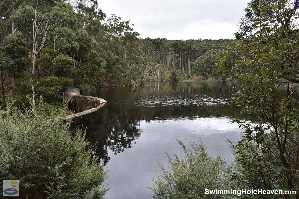
This former water supply reservoir for Ballan provides a 200 metre open water swim within a steep gully, with bush camping on the shoreline. The reservoir is accessible by 4WD to the
water's edge or a steep 600 metre walk from the nearest 2WD access road.
 Above: The curved dam wall and open water at Colbrook Reservoir
(Order this image)
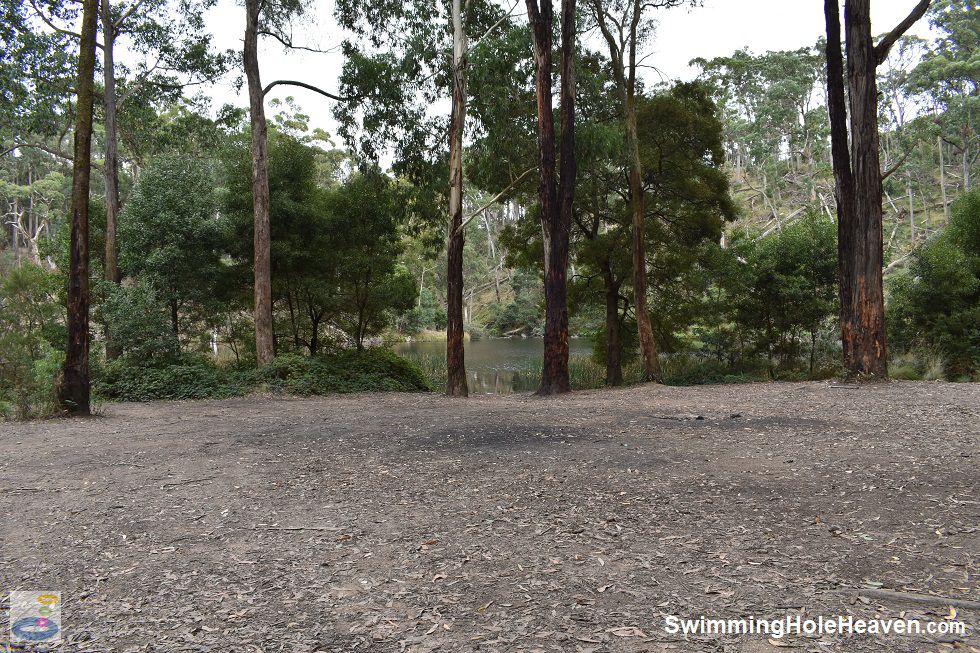
The dam wall is off limits, but on the eastern shore there are two cleared, bush camping areas for entering the water. There was a lot of soft mud and leaf litter under foot near the shore and I was sinking down to the base of my ankle, so swimming shoes are a good idea here.
However, once past this squishy mud and out through a large gap in the reeds, there is a long expanse of water. Because this reservoir is no longer used to
supply water, it usually stays close to full right through summer when other nearby reservoirs (like Pykes Creek Reservoir) are less attractive
for swimming because they have been drawn down low.
 Above: One of the bush campsites next to the water at Colbrook Reservoir
(Order this image)
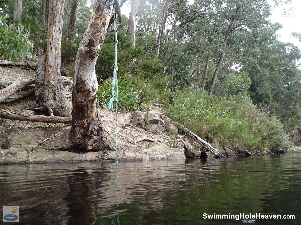
On the opposite bank of the reservoir there are a couple of rope swings. Rope swings are often placed in terrible positions, but this one was great. The rope was easy to grab and the steep gully meant that it was possible to get a good run up for the swing and the water was immediately very deep, with a near vertical drop away from the water's edge. As with any rope swing, always check the condition of the rope, the water depth, and for any obstacles under the water before you use the swing. Above: One of the rope swings over the water at Colbrook Reservoir
(Order this image)
If you are planning to camp here, the space available is limited to only a handful of spots, and there are no facilities other than a few makeshift firepits. Whilst this spot is difficult for most vehicles to access, have a backup plan for your camping on summer weekends in case the few spots available are occupied.
There was evidence of people also having camped next to Binks Road. If
you are leaving your vehicle on Binks Road and walking down to the reservoir, as I did, do not leave any valuables in the car, as there was shattered glass on the ground in this area, consistent with
vehicle break-ins.
Below is a video of my swim in Colbrook Reservoir on a cool day in Autumn.
View Larger Map
 Above: The curved dam wall and open water at Colbrook Reservoir
(Order this image)
The dam wall is off limits, but on the eastern shore there are two cleared, bush camping areas for entering the water. There was a lot of soft mud and leaf litter under foot near the shore and I was sinking down to the base of my ankle, so swimming shoes are a good idea here.
 Above: One of the bush campsites next to the water at Colbrook Reservoir
(Order this image)
On the opposite bank of the reservoir there are a couple of rope swings. Rope swings are often placed in terrible positions, but this one was great. The rope was easy to grab and the steep gully meant that it was possible to get a good run up for the swing and the water was immediately very deep, with a near vertical drop away from the water's edge. As with any rope swing, always check the condition of the rope, the water depth, and for any obstacles under the water before you use the swing.
 Above: One of the rope swings over the water at Colbrook Reservoir
(Order this image)
If you are planning to camp here, the space available is limited to only a handful of spots, and there are no facilities other than a few makeshift firepits. Whilst this spot is difficult for most vehicles to access, have a backup plan for your camping on summer weekends in case the few spots available are occupied.
Below is a video of my swim in Colbrook Reservoir on a cool day in Autumn.
Other Information Before You Go:
Location: Colbrook Reservoir on unnamed track off Binks Road, Colbrook, 13 km north of Ballan and 92 km north-west of the Melbourne CBD.
Latitude:-37.520911 Longitude:144.231734
Getting there: From the Western Fwy (M8) turn off at the Ballan exit (C803). From Ballan, head north along the Ballan-Greendale Road then 1 km north of the freeway turn left into Blakeville Road. Follow Blakeville Road for 8 km then turn right into Binks Road. Follow Binks Road for 1.9 km.
Park and walk or if you have a 4WD, choose any of the three 4WD tracks heading down to the reservoir.
Facilities: Informal fire pits. No other facilities.
Entrance fee: None
Water temperature: Cool to mild
Water clarity: Clear
Under foot: Mud and silt
Maximum water depth: Greater than 2 metres
Minimum swimming proficiency required: Experienced
Prohibitions including whether you can bring your dog: No walking on the dam wall, no access allowed on days of total fire ban, no digging for bait, no use of berley (fish bait). Dogs permitted.
Sun shade: Shade available over parts of the water in the morning and afternoon. Shade available out of the water.
Opening times: Always open except on days of total fire ban
Wheelchair access: None
Managing authority: Central Highlands Water
Nearby attractions: Pykes Creek Reservoir, 25 km by road to the south-east. Korweinguboora Creek, on which Colbrook Reservoir is located, eventually flows into Pykes Creek Reservoir.
Before you head out, make sure to read the swimming safety information and check with the managing authority for any current change of conditions.
Specific to this site, steer clear of the dam wall so there is no risk of being swept over when the creek is running.
Latitude:-37.520911 Longitude:144.231734
Getting there: From the Western Fwy (M8) turn off at the Ballan exit (C803). From Ballan, head north along the Ballan-Greendale Road then 1 km north of the freeway turn left into Blakeville Road. Follow Blakeville Road for 8 km then turn right into Binks Road. Follow Binks Road for 1.9 km.
Facilities: Informal fire pits. No other facilities.
Entrance fee: None
Water temperature: Cool to mild
Water clarity: Clear
Under foot: Mud and silt
Maximum water depth: Greater than 2 metres
Minimum swimming proficiency required: Experienced
Prohibitions including whether you can bring your dog: No walking on the dam wall, no access allowed on days of total fire ban, no digging for bait, no use of berley (fish bait). Dogs permitted.
Sun shade: Shade available over parts of the water in the morning and afternoon. Shade available out of the water.
Opening times: Always open except on days of total fire ban
Wheelchair access: None
Managing authority: Central Highlands Water
Nearby attractions: Pykes Creek Reservoir, 25 km by road to the south-east. Korweinguboora Creek, on which Colbrook Reservoir is located, eventually flows into Pykes Creek Reservoir.
Locality Map:
The marker indicates the approximate location of one of the cleared areas where I entered the water. If the map is not zoomed in locally, as can sometimes occur when loading, simply click or tap on "View Larger Map" below.
View Larger Map
Comments:
If you would like to leave a comment about this swimming hole, please fill in the comment box below. I'm particularly interested in your
experiences after visiting, and any changes in swimming conditions. All fields are required if you would like your comments published on this website.
| ← Back stroke | Next swim → |
| Victoria | Western VIC |
| Water Safety | Map |
| List of Lists | Suggest a Swim |
| Links | Your Support |
| Media | Order the Book |
|
|
|
|
|
|
|
|
|
|
© Brad Neal 2024. All rights reserved. Swimming Hole Heaven is a registered trademark. Here are my
affiliate links and cookies policy and opportunities to provide support to Swimming Hole Heaven.