| ← Back stroke | Next swim → |
Shaws Lake, BlackwoodSwimming Hole Heaven in Victoria
| World Home Page |
| Australia Home |
| VIC Home |
| Regions of Victoria: |
| Melbourne |
| North East Victoria |
| Gippsland |
| Western Victoria |
| Other information: |
| Water Safety |
| Map |
| List of Lists |
| Order the Book |
| Your Support |
More of a farm dam than a lake, swim horizontally to stay warm in this heavily stratified lake with a very cold layer underneath. During my
swim here, the water was quite mild across the surface, but as soon as I put my legs down and treaded water, it was like dropping your
feet into an ice box.
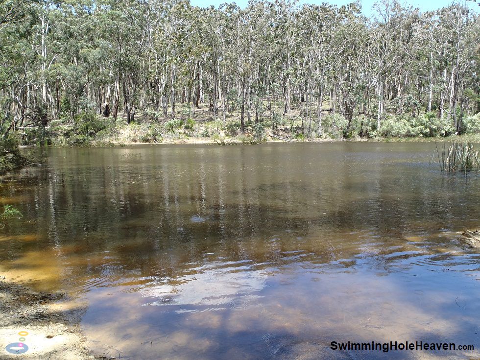
 Above: The best entry into the water for swimming at Shaws Lake in Blackwood
(Order this image)
The lake gets deep fairly quickly away from the bank, particularly as you swim across the lake, parallel with the dam wall. This constructed dam is not the prettiest swim in the region, with dry and dusty tracks leading down to the water through a thin, parched eucalypt forest that looks on enviously at this water body. However the water is refreshing with plenty of room to swim back and forth.
Getting into the water is easiest from the north-west corner, straight down the hill from the picnic area. Here there are no reeds and the entry is fairly gradual. From here you can push off into deeper water and swim around 30-40 metres uninterrupted towards the opposite bank. Access from the northern end of the lake along the dam wall is difficult due to the steep entry, and the eastern and southern shores are lined by thick reeds and fallen trees.
The space available to wade in the shallows and enter/exit the lake is relatively small, so if there are other people here
before you, there might be some swimming traffic in that corner of the lake. Due to the depth and restricted shore access, an inflatable would be desirable
if you are planning to spend a lot of time in the water here.
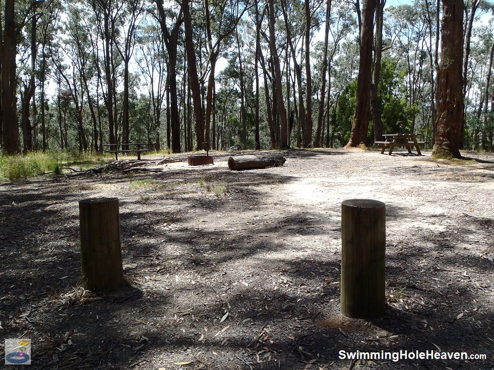
 Above: The picnic area at the top of the hill at Shaws Lake in Blackwood
(Order this image)
The picnic facilities at the top of the hill are fairly basic, but sufficient for a picnic or wood fired barbecue after your swim.
The main advantage of this swimming spot is that because the base and wall of the dam are lined with clay, it holds water throughout summer. On my most recent visit in mid-January, the Lerderderg River at the nearby mineral springs was only a trickle, but Shaws Lake was still full of water.
It is good to know that
when you aim for the Lerderderg River and it is running dry and stagnating, Shaws Lake can be a reliable backup swim.
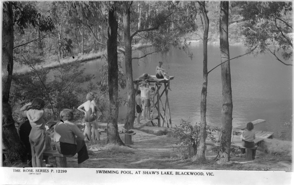
This lake was a popular swimming spot, captured on a postcard in the first half of the 20th century. State Library archives show the lake had a tower and a small jetty leading out into the water (see below). I could not see any sign of this past infrastructure when visiting here, with only a few more recent fallen logs at the site of the tower. Above: Historical swimming at Shaws Lake in Blackwood, circa 1920-1954, sourced from the State Library of Victoria
Below is a quick video guide to swimming at the lake including testing with a temperature probe why my feet felt so cold in the water but my hands did not. I tested this on two separate visits and got the same results.
View Larger Map
 Above: The best entry into the water for swimming at Shaws Lake in Blackwood
(Order this image)
The lake gets deep fairly quickly away from the bank, particularly as you swim across the lake, parallel with the dam wall. This constructed dam is not the prettiest swim in the region, with dry and dusty tracks leading down to the water through a thin, parched eucalypt forest that looks on enviously at this water body. However the water is refreshing with plenty of room to swim back and forth.
Getting into the water is easiest from the north-west corner, straight down the hill from the picnic area. Here there are no reeds and the entry is fairly gradual. From here you can push off into deeper water and swim around 30-40 metres uninterrupted towards the opposite bank. Access from the northern end of the lake along the dam wall is difficult due to the steep entry, and the eastern and southern shores are lined by thick reeds and fallen trees.
 Above: The picnic area at the top of the hill at Shaws Lake in Blackwood
(Order this image)
The picnic facilities at the top of the hill are fairly basic, but sufficient for a picnic or wood fired barbecue after your swim.
The main advantage of this swimming spot is that because the base and wall of the dam are lined with clay, it holds water throughout summer. On my most recent visit in mid-January, the Lerderderg River at the nearby mineral springs was only a trickle, but Shaws Lake was still full of water.
This lake was a popular swimming spot, captured on a postcard in the first half of the 20th century. State Library archives show the lake had a tower and a small jetty leading out into the water (see below). I could not see any sign of this past infrastructure when visiting here, with only a few more recent fallen logs at the site of the tower.
 Above: Historical swimming at Shaws Lake in Blackwood, circa 1920-1954, sourced from the State Library of Victoria
Below is a quick video guide to swimming at the lake including testing with a temperature probe why my feet felt so cold in the water but my hands did not. I tested this on two separate visits and got the same results.
Other Information Before You Go:
Location: Shaws Lake Picnic Area, Lerderderg State Park, Shaws Lake Track, Blackwood, 95 km (approx. 1 hr 20 minute drive) north west of the Melbourne CBD
Latitude:-37.468530 Longitude:144.319878
Getting there: From Melbourne head along the Western Fwy and turn off at the Greendale exit (route C318) near Myrniong. Follow the road north for 16 km and then head east along Old Golden Point Rd, just before reaching Blackwood. After 1 km turn right into Golden Point Road, then after a further 750 metres, head left into North Blackwood Road. Follow this unsealed road for 1.6 km, before taking a hairpin turn into Shaws Lake Track. The car park for the picnic area is approximately 1 km from the hairpin turn. On my visit, in dry weather, the road was suitable for 2WD vehicles. The lake is about a 50 metre walk downhill from the picnic area.
Facilities: Picnic tables, car park, fire places, rotunda, information boards. There are no bins so take your rubbish with you, and no toilets. Toilets are available at the Blackwood Mineral Springs, a 1.6 km walk along the track that runs down the hill.
Entrance fee: None
Water temperature: Mild to cold
Water clarity: Cloudy
Under foot: Coarse sand and clay
Maximum water depth: Greater than 2 metres
Minimum swimming proficiency required: Experienced due to the poor visibility and rapid changes in temperature at depth. Inexperienced swimmers could wade into the water, under supervision, in the north-west corner of the lake.
Prohibitions including whether you can bring your dog: Only light fires in the fireplaces provided. No firearms, cats or other pets. No disturbing or removal of plants, animals, other natural features and cultural sites. No feeding wildlife.
Sun shade: Shade available in and out of the water
Opening times: Always open
Wheelchair access: The picnic area next to the car park is reasonably flat, but there is no wheelchair access provided to the water.
Managing authority: Parks Victoria
Nearby attractions: Blackwood mineral springs, which are a 1.6 km walk downhill from Shaws Lake, or go for a swim in Lerderderg Gorge at the southern end of the Lerderderg State Park.
Before you head out, make sure to read the swimming safety information and check with the managing authority for any current change of conditions.
Latitude:-37.468530 Longitude:144.319878
Getting there: From Melbourne head along the Western Fwy and turn off at the Greendale exit (route C318) near Myrniong. Follow the road north for 16 km and then head east along Old Golden Point Rd, just before reaching Blackwood. After 1 km turn right into Golden Point Road, then after a further 750 metres, head left into North Blackwood Road. Follow this unsealed road for 1.6 km, before taking a hairpin turn into Shaws Lake Track. The car park for the picnic area is approximately 1 km from the hairpin turn. On my visit, in dry weather, the road was suitable for 2WD vehicles. The lake is about a 50 metre walk downhill from the picnic area.
Facilities: Picnic tables, car park, fire places, rotunda, information boards. There are no bins so take your rubbish with you, and no toilets. Toilets are available at the Blackwood Mineral Springs, a 1.6 km walk along the track that runs down the hill.
Entrance fee: None
Water temperature: Mild to cold
Water clarity: Cloudy
Under foot: Coarse sand and clay
Maximum water depth: Greater than 2 metres
Minimum swimming proficiency required: Experienced due to the poor visibility and rapid changes in temperature at depth. Inexperienced swimmers could wade into the water, under supervision, in the north-west corner of the lake.
Prohibitions including whether you can bring your dog: Only light fires in the fireplaces provided. No firearms, cats or other pets. No disturbing or removal of plants, animals, other natural features and cultural sites. No feeding wildlife.
Sun shade: Shade available in and out of the water
Opening times: Always open
Wheelchair access: The picnic area next to the car park is reasonably flat, but there is no wheelchair access provided to the water.
Managing authority: Parks Victoria
Nearby attractions: Blackwood mineral springs, which are a 1.6 km walk downhill from Shaws Lake, or go for a swim in Lerderderg Gorge at the southern end of the Lerderderg State Park.
Locality Map:
The marker indicates the approximate location of the car park in the picnic area near the lake. If the map is not zoomed in locally, as can occur with some browsers, simply click or tap on "View Larger Map" below.
View Larger Map
Comments:
If you would like to leave a comment about this swimming hole, please fill in the comment box below. I'm particularly interested in your
experiences after visiting, and any changes in swimming conditions. All fields are required if you would like your comments published on this website.
| ← Back stroke | Next swim → |
| Victoria | Western VIC |
| Water Safety | Map |
| List of Lists | Suggest a Swim |
| Links | Your Support |
| Media | Order the Book |
|
|
|
|
|
|
|
|
|
|
© Brad Neal 2024. All rights reserved. Swimming Hole Heaven is a registered trademark. Here are my
affiliate links and cookies policy and opportunities to provide support to Swimming Hole Heaven.