| ← Back stroke | Next swim → |
Casuarina SandsMurrumbidgee River, Stromlo ACT
| World Home Page |
| Australia Home |
| NSW / ACT Home |
| NSW and ACT Regions: |
| Canberra and ACT |
| South Coast |
| Southern Inland |
| Sydney |
| Other information: |
| Water Safety |
| Map |
| List of Lists |
| Your Support |
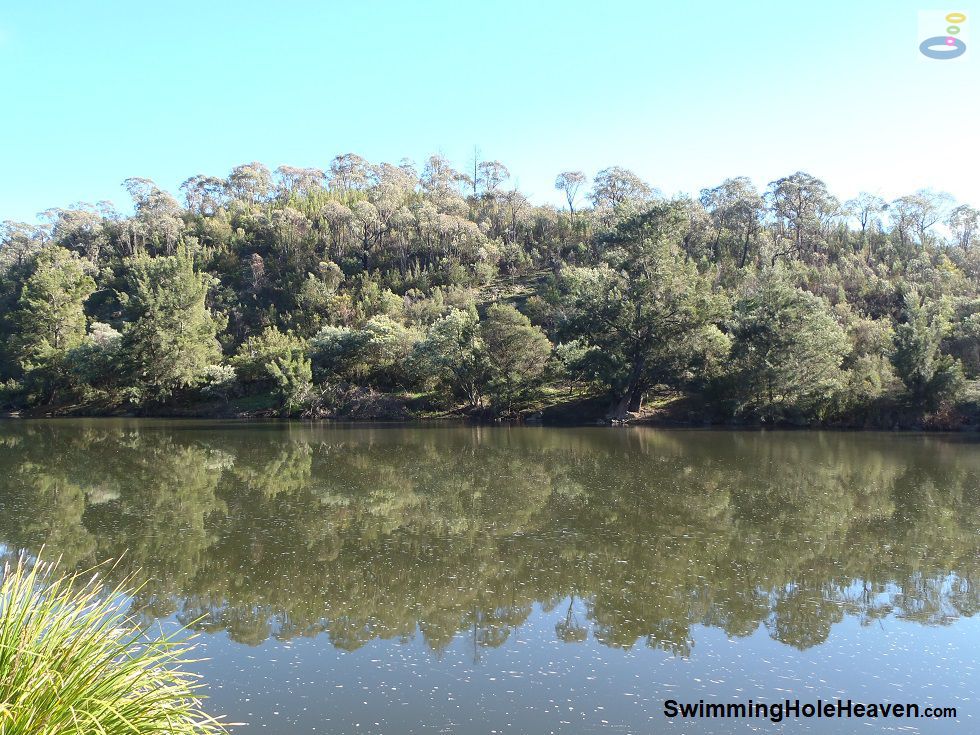
The Murrumbidgee River at Casuarina Sands is a popular, deeper water swim along the river, with a downstream
weir backing up the flow to create a long pool. From the park entrance head left to the two sandy beaches in
front of the western car park, particularly if you are also planning a picnic, or turn right to the eastern
car park to reach deeper water and either float or follow the walking trail down towards the weir.
 Above: The weir pool when the river was moderately full
(Order this image)
The shallower, western end of this stretch of river provides easier entry to the water and has much more space on the bank to spread out on a busy swimming day. The facilities here are also much better if you are planning a few ball games or a barbecue out of the water.
It is here that you will see more of the Casuarina trees that lend this place its name, rising up from the sand on the floodplain next to the river.
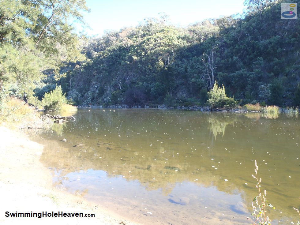
The best beach is actually slightly to the left of the barbecues, just at the bend in the river below a set of rapids. The backdrop for your swim here
is a craggly granite cliff on the opposite bank of the river.
 Above: The western end of Casuarina Sands, looking upstream from the smaller beach
(Order this image)
The eastern (downstream) end of Casuarina Sands offers a deeper swim. I found the water here a bit murkier because of the depth, and the river bed dropped away almost immediately away from the shore. There are a few small sandy entry points to the water, including one just to the left of the car park, but most seem to get deep quickly.
If the river level is low, you will need to walk downstream along the path that runs along
the river to find the longest stretch of deep water. This spot is great for a genuine swim or on an inflatable, as long as you are mindful of the current.
Casuarina Sands is one of six swimming spots that were formally recommended by the ACT Minister for Territory and Municipal Services. The Minister described it as "a great place to relax and have a picnic" (20/12/12). Endorse the Minister's comment with a sausage in bread after your swim.
Water quality in the Canberra area can sometimes be unsuitable for swimming. For regular updates on whether the water quality at this site is suitable for swimming, see the ACT Government's water quality alerts. Signs on site indicate when the river is closed for swimming due to poor water quality. As a general rule, don't plan to swim here after rain because the river may be closed to swimming due to agricultural runoff from upstream areas (i.e. animal faeces, fertilisers, herbicides, pesticides, etc.).
View Larger Map
 Above: The weir pool when the river was moderately full
(Order this image)
The shallower, western end of this stretch of river provides easier entry to the water and has much more space on the bank to spread out on a busy swimming day. The facilities here are also much better if you are planning a few ball games or a barbecue out of the water.
 Above: The western end of Casuarina Sands, looking upstream from the smaller beach
(Order this image)
The eastern (downstream) end of Casuarina Sands offers a deeper swim. I found the water here a bit murkier because of the depth, and the river bed dropped away almost immediately away from the shore. There are a few small sandy entry points to the water, including one just to the left of the car park, but most seem to get deep quickly.
Casuarina Sands is one of six swimming spots that were formally recommended by the ACT Minister for Territory and Municipal Services. The Minister described it as "a great place to relax and have a picnic" (20/12/12). Endorse the Minister's comment with a sausage in bread after your swim.
Other Information Before You Go:
Location: Cotter Road, Stromlo, ACT, 22 km (approx. 25 min. drive) west of Canberra Central.
Latitude:-35.319262 Longitude:148.952217
Getting there: From parliament house, head west along Adelaide Avenue / Cotter Road. Casuarina Sands is at the hairpin bend in Cotter Road, just before you cross the Murrumbidgee River.
Facilities: Car park, toilets, wood barbecues (BYO wood), picnic tables, playground, drinking water, picnic shelter.
Entrance fee: None
Water temperature: Mild
Water clarity: Clear to cloudy
Under foot: Sand, rock
Maximum water depth: Greater than 2 metres
Suggested minimum swimming proficiency required: Experienced. There have been several drownings here over the years.
Prohibitions including whether you can bring your dog: No dogs. No rubbish bins provided, so take your rubbish home with you.
Collection of standing or fallen timber is illegal, so BYO wood for the barbecues.
Sun shade: Shade available out of the water. No shade available in the water.
Opening times: Always open
Wheelchair access: Wheelchair accessible paths and toilet
Managing authority: ACT Government
Nearby attractions: Cotter River at Cotter Campground, which is just over a kilometre upstream on the Cotter River.
Before you head out, make sure to read the
swimming safety information and check with the managing authority for any current change of conditions. This spot has been the site of several
drownings over the years, including one as recent as December 2016. Most of these occurred prior to modifications to the weir wall
in 1991 to improve its safety. If you are not a strong swimmer, stay well away from the weir pool, and restrict your swimming to
where you can stand up at the beaches near the western car park. Specific to this site, the managing authority advises that there are
strong currents, shallow water, submerged objects, deep water, slippery and uneven ground, steep banks and snakes. The managing authority
also advises that mobile phone reception is not reliable throughout the Murrumbidgee River corridor, so do not depend on your phone
for safety or directions. If you are kayaking, please steer well clear of swimmers in the water.
Latitude:-35.319262 Longitude:148.952217
Getting there: From parliament house, head west along Adelaide Avenue / Cotter Road. Casuarina Sands is at the hairpin bend in Cotter Road, just before you cross the Murrumbidgee River.
Facilities: Car park, toilets, wood barbecues (BYO wood), picnic tables, playground, drinking water, picnic shelter.
Entrance fee: None
Water temperature: Mild
Water clarity: Clear to cloudy
Under foot: Sand, rock
Maximum water depth: Greater than 2 metres
Suggested minimum swimming proficiency required: Experienced. There have been several drownings here over the years.
Prohibitions including whether you can bring your dog: No dogs. No rubbish bins provided, so take your rubbish home with you.
Sun shade: Shade available out of the water. No shade available in the water.
Opening times: Always open
Wheelchair access: Wheelchair accessible paths and toilet
Managing authority: ACT Government
Nearby attractions: Cotter River at Cotter Campground, which is just over a kilometre upstream on the Cotter River.
Water quality in the Canberra area can sometimes be unsuitable for swimming. For regular updates on whether the water quality at this site is suitable for swimming, see the ACT Government's water quality alerts. Signs on site indicate when the river is closed for swimming due to poor water quality. As a general rule, don't plan to swim here after rain because the river may be closed to swimming due to agricultural runoff from upstream areas (i.e. animal faeces, fertilisers, herbicides, pesticides, etc.).
Locality Map:
The marker indicates the approximate location of the main beach at Casuarina Sands. If the map is not zoomed in locally, as can sometimes occur when loading, simply click or tap on "View Larger Map" below.
View Larger Map
Comments:
If you would like to leave a comment about this swimming spot, please fill in the comment box below.
I'm particularly interested in your experiences after visiting, and any changes in conditions, etc.
All fields are required if you would like your comments published on this website.
| ← Back stroke | Next swim → |
| NSW Home | ACT Home |
| Water Safety | Map |
| Links | Your Support |
| List of Lists | Suggest a Swim |
| Community, Media, Research | |
|
|
|
|
|
|
|
|
|
|
© Brad Neal 2024. All rights reserved. Swimming Hole Heaven is a registered trademark. Here are my
affiliate links and cookies policy and opportunities to provide support to Swimming Hole Heaven.