| ← Back stroke | Next swim → |
Lake Eckersley ForeshoreHeathcote National Park, New South Wales
| World Home Page |
| Australia Home |
| NSW / ACT Home |
| NSW and ACT Regions: |
| Canberra and ACT |
| South Coast |
| Southern Inland |
| Sydney |
| Other information: |
| Water Safety |
| Map |
| List of Lists |
| Your Support |
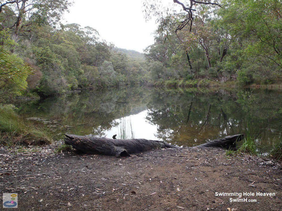
What I've termed Lake Eckersley Foreshore, so as to distinguish it from my swim at the downstream campground, is the point
at which you first encounter Lake Eckersley on the walking track down to the Woronora River. This little cleared area
with a span no more than a few metres, provides the only panoramic view
of the lake. Here the lake is at its widest point, at around 50 metres across. Stepping off the thick log that is jammed into
the bank, entry into the water is immediately waist deep.
 Above: Looking across Lake Eckersley at its widest point, with the rope swing in the distance
(Order this image)
After the several kilometre walk from Heathcote or Waterfall, a dip in the water here seems inviting. However there are a few things to watch out for in the water. Immediately to the right of this area of foreshore, there was a large semi-submerged snag that you would do well to steer clear of. Secondly, on either side of the entry point, there was visible algal and weed growth.
An eel was breaking the surface nearby,
and whilst they are fairly placid if you don't provoke them, their presence can be offputting for some.
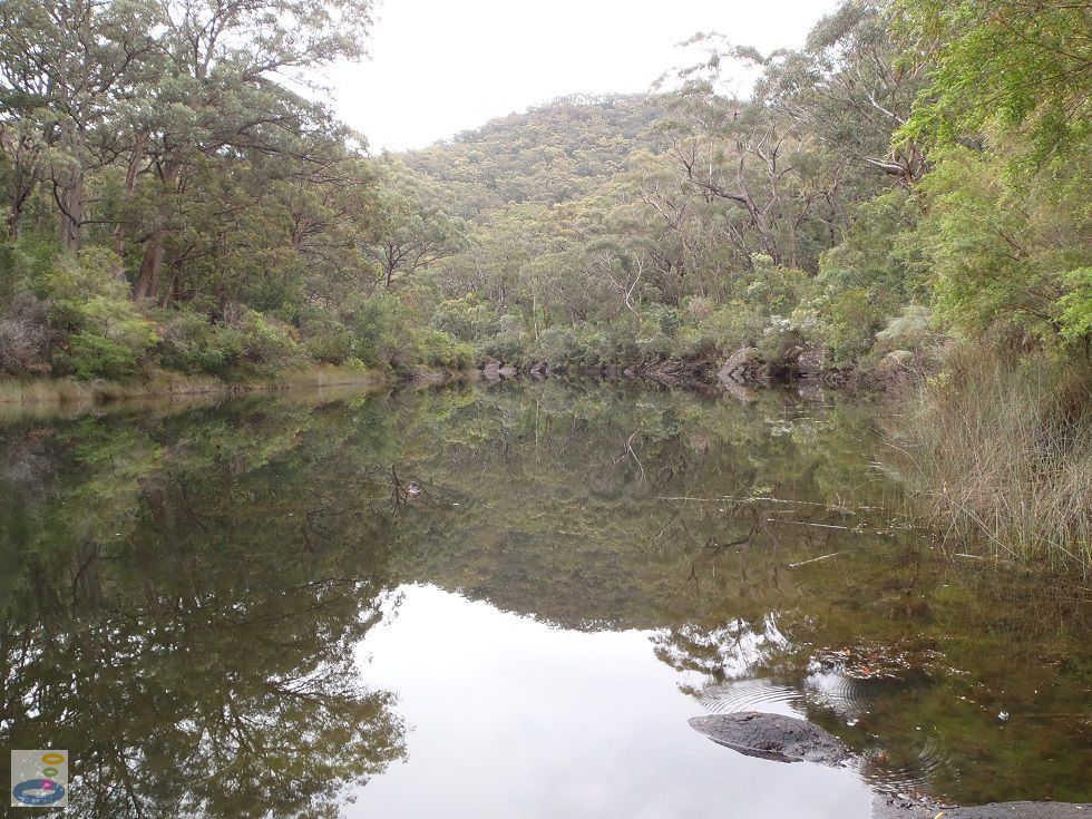
 Above: Looking downstream along Lake Eckersley
(Order this image)
To enjoy this swim, you need to push off from the shore fairly quickly into deeper water away from these hazards and distractions. The current was not particularly strong when I visited, and you can cover quite long distances in the water upstream and downstream, provided you stay away from the lake edge.
On the far side of the lake, a couple of rope swings beckon for those who can make the journey across.
If you are looking for a swim in Lake Eckersley in cleaner water with easier entry, I strongly recommend you head a few hundred metres downstream to one of my favourite swims at Lake Eckersley Campground. This small cleared area that I have termed the foreshore is mistaken by both Google Maps and the managing authority's website as the campground, but it is actually not. The following video covers both areas, including how to get from the foreshore to the campground.
View Larger Map
 Above: Looking across Lake Eckersley at its widest point, with the rope swing in the distance
(Order this image)
After the several kilometre walk from Heathcote or Waterfall, a dip in the water here seems inviting. However there are a few things to watch out for in the water. Immediately to the right of this area of foreshore, there was a large semi-submerged snag that you would do well to steer clear of. Secondly, on either side of the entry point, there was visible algal and weed growth.
 Above: Looking downstream along Lake Eckersley
(Order this image)
To enjoy this swim, you need to push off from the shore fairly quickly into deeper water away from these hazards and distractions. The current was not particularly strong when I visited, and you can cover quite long distances in the water upstream and downstream, provided you stay away from the lake edge.
If you are looking for a swim in Lake Eckersley in cleaner water with easier entry, I strongly recommend you head a few hundred metres downstream to one of my favourite swims at Lake Eckersley Campground. This small cleared area that I have termed the foreshore is mistaken by both Google Maps and the managing authority's website as the campground, but it is actually not. The following video covers both areas, including how to get from the foreshore to the campground.
Other Information Before You Go:
Location: Accessible from the Pipeline Trail, Heathcote National Park, near Heathcote,
38 km (approx. 1 hr drive to the start of the walk) south-west of Sydney.
Latitude:-34.096098 Longitude:150.976225
Getting there: There are several access points for the Pipeline Trail. I started from the Goburra Track, at the end of Oliver Street in Heathcote, where you can park your car on the side of the road. This track takes you over the hill and down natural sandstone steps to the Pipeline Trail. Follow the Pipeline Trail for approximately 4 km. About 2 km past Mirang Pool there is a sign clearly indicating the track to Lake Eckersley. This swim is in the small cleared area when you first encounter the lake. Walking is very easy along the Pipeline Trail, but moderately steep down Goburra Track and again down to Lake Eckersley. You can also catch the train to Heathcote, and then it's a 1 km walk across the Princes Hwy and down Oliver Street to the start of the walking track.
Facilities: None
Entrance fee: None
Water temperature: Mild
Water clarity: Clear
Under foot: Sand and gravel with some leaf litter
Maximum water depth: Greater than 2 metres
Minimum swimming proficiency required: Experienced
Prohibitions including whether you can bring your dog: No pets other than certified assistance animals, no smoking, no campfires, no solid fuel burners, no gathering firewood, no generators, no amplified music.
Sun shade: Shade available in the water near the lake edge, but not in the middle of the lake. Shade available out of the water.
Opening times: Always open
Wheelchair access: None
Managing authority: NSW National Parks and Wildlife Service
Nearby attractions: Lake Eckersley Campground, 300 metres downstream, and the Pipeline/Bullawarring Trail Junction, 500 metres back towards Heathcote along the Pipeline Trail.
Before you head out, make sure to read the
swimming safety information and check with the managing authority for any current change of conditions.
Latitude:-34.096098 Longitude:150.976225
Getting there: There are several access points for the Pipeline Trail. I started from the Goburra Track, at the end of Oliver Street in Heathcote, where you can park your car on the side of the road. This track takes you over the hill and down natural sandstone steps to the Pipeline Trail. Follow the Pipeline Trail for approximately 4 km. About 2 km past Mirang Pool there is a sign clearly indicating the track to Lake Eckersley. This swim is in the small cleared area when you first encounter the lake. Walking is very easy along the Pipeline Trail, but moderately steep down Goburra Track and again down to Lake Eckersley. You can also catch the train to Heathcote, and then it's a 1 km walk across the Princes Hwy and down Oliver Street to the start of the walking track.
Facilities: None
Entrance fee: None
Water temperature: Mild
Water clarity: Clear
Under foot: Sand and gravel with some leaf litter
Maximum water depth: Greater than 2 metres
Minimum swimming proficiency required: Experienced
Prohibitions including whether you can bring your dog: No pets other than certified assistance animals, no smoking, no campfires, no solid fuel burners, no gathering firewood, no generators, no amplified music.
Sun shade: Shade available in the water near the lake edge, but not in the middle of the lake. Shade available out of the water.
Opening times: Always open
Wheelchair access: None
Managing authority: NSW National Parks and Wildlife Service
Nearby attractions: Lake Eckersley Campground, 300 metres downstream, and the Pipeline/Bullawarring Trail Junction, 500 metres back towards Heathcote along the Pipeline Trail.
Locality Map:
The marker indicates the approximate location of the foreshore area for this swim. If the map is not zoomed in locally, as can sometimes occur when loading, simply click or tap on "View Larger Map" below.
View Larger Map
Comments:
If you would like to leave a comment about this swimming spot, please fill in the comment box below.
I am particularly interested in your experiences after visiting, and any changes in conditions, etc.
All fields are required if you would like your comments published on this website.
| ← Back stroke | Next swim → |
| NSW / ACT | Sydney |
| Water Safety | Map |
| Links | Your Support |
| List of Lists | Suggest a Swim |
| Community, Media, Research | |
|
|
|
|
|
|
|
|
|
|
© Brad Neal 2024. All rights reserved. Swimming Hole Heaven is a registered trademark. Here is my
affiliate links and cookies policy and opportunities to provide support to Swimming Hole Heaven.