| ← Back stroke | Next swim → |
Hennessy Beach, TocumwalSwimming Hole Heaven in NSW
| World Home Page |
| Australia Home |
| NSW / ACT Home |
| NSW and ACT Regions: |
| Canberra and ACT |
| South Coast |
| Southern Inland |
| Sydney |
| Other information: |
| Water Safety |
| Map |
| List of Lists |
| Your Support |
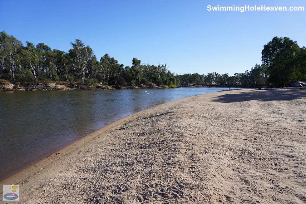
At the end of a rough, uneven track, this long sandy beach on the outskirts of Tocumwal faces west to catch the late afternoon sun. The beach itself is
long with shallow entry close to the shore at most river levels.
 Above: The view along Hennessy Beach at Tocumwal
(Order this image)
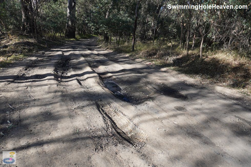
Getting to this spot was slightly more difficult than other beaches around Tocumwal, with the dirt track off Tuppal Road likely to discourage any 2WD vehicles with a low wheel base.
Instructions for getting here are provided below, noting that I would avoid this spot in wet weather, unless you are an experienced 4WD driver.
 Above: The short track to the beach with wheel ruts
(Order this image)
After passing through the little patch of scrub, the space expanded quite remarkably when I reached the beach, with the open water ahead and the absence of trees overhead. The waterfront is quite expansive, with a long sandy beach and some sparse, short grasses on relatively flat ground at the back of the beach that looked reasonably good for camping.
There were also a few shade trees scattered around. Overhead was the noise of a large flock of cockatoos constantly screeching. I was not sure
if they were short-time visitors or long-term residents, but they were certainly making themselves at home.
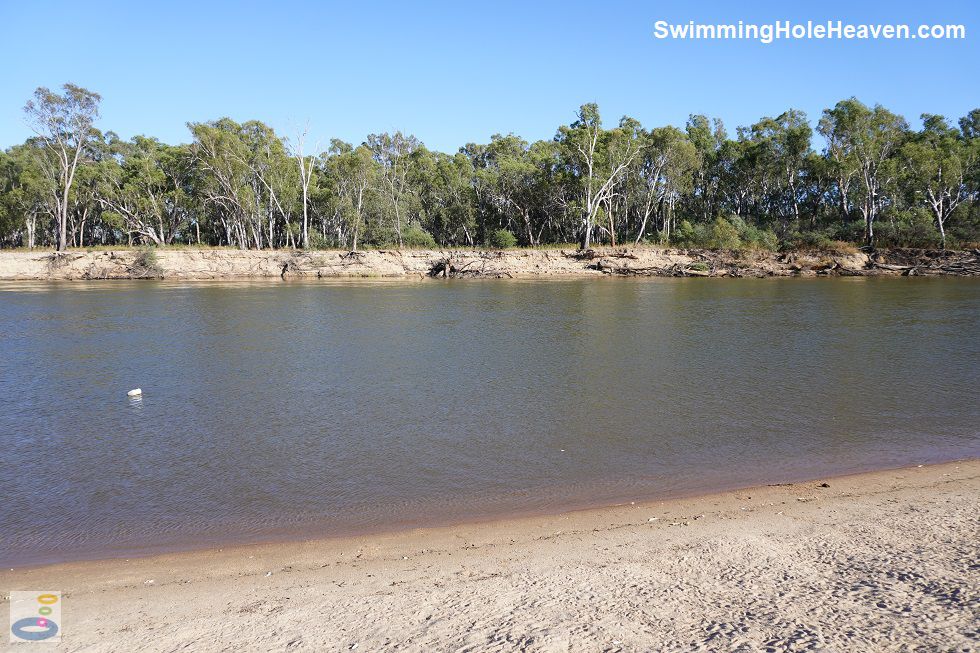
 Above: Looking across from Hennessy Beach to the opposite bank
(Order this image)
The water was shallow away from the bank, with the main channel on the far side, however I did notice a sharp break of slope on the beach that might mean steeper entry to the water if the river was running half a metre higher, as it probably would in mid-summer. Like other nearby swims, the current was swift and became stronger than you could swim against, further out into the water. There was however a little backwater at the downstream end of the beach that was free of any strong currents, but which also looks like it would be a popular spot to park your boat, so may not always be free for swimming.
View Larger Map
 Above: The view along Hennessy Beach at Tocumwal
(Order this image)
Getting to this spot was slightly more difficult than other beaches around Tocumwal, with the dirt track off Tuppal Road likely to discourage any 2WD vehicles with a low wheel base.
 Above: The short track to the beach with wheel ruts
(Order this image)
After passing through the little patch of scrub, the space expanded quite remarkably when I reached the beach, with the open water ahead and the absence of trees overhead. The waterfront is quite expansive, with a long sandy beach and some sparse, short grasses on relatively flat ground at the back of the beach that looked reasonably good for camping.
 Above: Looking across from Hennessy Beach to the opposite bank
(Order this image)
The water was shallow away from the bank, with the main channel on the far side, however I did notice a sharp break of slope on the beach that might mean steeper entry to the water if the river was running half a metre higher, as it probably would in mid-summer. Like other nearby swims, the current was swift and became stronger than you could swim against, further out into the water. There was however a little backwater at the downstream end of the beach that was free of any strong currents, but which also looks like it would be a popular spot to park your boat, so may not always be free for swimming.
Other Information Before You Go:
Location: Sonnemans Travelling Stock Reserve, off Tuppal Road, Tocumwal, New South Wales, 270 km (approx. 3 hr drive) north of the Melbourne CBD
Latitude:-35.805458 Longitude:145.535086
Getting there: From Dean Street / the Newell Hwy (A39) in town, head west along Tuppal Road for 2 km. Follow the unnamed dirt road on the southern side of the road (signposted as the Sonnemans Travelling Stock Reserve) around to the right then up over a little hill. Over the hill, turn left along the dirt track and follow it for around 200 metres through the bush until it bends around to the right towards the river. The area opens up when you reach the beach. The track had deep wheel ruts on my visit, so a 4WD vehicle is recommended, but some people had brought their caravans through. The track might not be passable during or after wet weather.
Facilities: There is a boat ramp when you first enter Sonnemans Travelling Stock Reserve. No other facilities. There are no rubbish bins, so take your rubbish home with you.
Entrance fee: None
Water temperature: Mild
Water clarity: Clear
Under foot: Sand
Maximum water depth: Greater than 2 metres
Minimum swimming proficiency required: Beginners, under strict supervision, in the shallow water. Elsewhere experienced swimmers only due to the strong current.
Prohibitions including whether you can bring your dog: No shooting, no motorbikes, no chainsaws. There was one other prohibition on the sign that looked like it might be related to campfires, but it had worn away and I could not read it properly. Camping permitted with a permit from the Tocumwal Information Centre in Deniliquin St in town. Dogs permitted.
Sun shade: No shade available over most of the beach, with only a few isolated gum trees providing shade. Shade available at the back of the beach.
Opening times: Always open
Wheelchair access: Can drive to the beach but need to cross the sand to reach the water.
Managing authority: Murray Local Lands Services Board
Nearby attractions: Town Beach on the River Murray on the other side of town, 4 km to the south-east.
Before you head out, make sure to read the
swimming safety information and check with the managing authority for any current change of conditions. Specific to this site, the managing authority posted numerous
general warnings on site, including about the strong currents, submerged objects, shallow water, deep water, boat ramp, power craft, pedestrians, falling branches, uneven ground, livestock, and
native wildlife.
Latitude:-35.805458 Longitude:145.535086
Getting there: From Dean Street / the Newell Hwy (A39) in town, head west along Tuppal Road for 2 km. Follow the unnamed dirt road on the southern side of the road (signposted as the Sonnemans Travelling Stock Reserve) around to the right then up over a little hill. Over the hill, turn left along the dirt track and follow it for around 200 metres through the bush until it bends around to the right towards the river. The area opens up when you reach the beach. The track had deep wheel ruts on my visit, so a 4WD vehicle is recommended, but some people had brought their caravans through. The track might not be passable during or after wet weather.
Facilities: There is a boat ramp when you first enter Sonnemans Travelling Stock Reserve. No other facilities. There are no rubbish bins, so take your rubbish home with you.
Entrance fee: None
Water temperature: Mild
Water clarity: Clear
Under foot: Sand
Maximum water depth: Greater than 2 metres
Minimum swimming proficiency required: Beginners, under strict supervision, in the shallow water. Elsewhere experienced swimmers only due to the strong current.
Prohibitions including whether you can bring your dog: No shooting, no motorbikes, no chainsaws. There was one other prohibition on the sign that looked like it might be related to campfires, but it had worn away and I could not read it properly. Camping permitted with a permit from the Tocumwal Information Centre in Deniliquin St in town. Dogs permitted.
Sun shade: No shade available over most of the beach, with only a few isolated gum trees providing shade. Shade available at the back of the beach.
Opening times: Always open
Wheelchair access: Can drive to the beach but need to cross the sand to reach the water.
Managing authority: Murray Local Lands Services Board
Nearby attractions: Town Beach on the River Murray on the other side of town, 4 km to the south-east.
Locality Map:
The marker indicates the approximate location of the beach. If the map is not zoomed in locally, as can sometimes occur when loading, simply click or tap on "View Larger Map" below.
View Larger Map
Comments:
If you would like to leave a comment about this swimming spot, please fill in the comment box below.
I am particularly interested in your experiences after visiting, and any changes in conditions, etc.
All fields are required if you would like to see your comments appear on this website.
| ← Back stroke | Next swim → |
| NSW / ACT | Inland Sth NSW |
| Water Safety | Map |
| Links | Your Support |
| List of Lists | Suggest a Swim |
| Community, Media, Research | |
|
|
|
|
|
|
|
|
|
|
© Brad Neal 2024. All rights reserved. Swimming Hole Heaven is a registered trademark. Here is my
affiliate links and cookies policy and opportunities to provide support to Swimming Hole Heaven.